Is Boerum Hill Safe? Brooklyn Livability, Crime & Rent
Choose Boerum Hill if your commute to Manhattan or your work-from-home routine is non-negotiable and you prioritize restaurant access over parks; otherwise, compare to neighborhoods with stronger outdoor infrastructure at the same transit tier.
Boerum Hill at a glance
- Borough
- Brooklyn
- Livability score
- 5.5/10
- Borough rank
- #20 of 32
- Median listing
- $965K
- Subway stations
- 7 (Nevins St, High St, Borough Hall/Court St)
- Active listings
- 73
- Data updated
- 2026-04-05
Is Boerum Hill Safe?
Boerum Hill, Brooklyn scores 5.5/10 for overall livability, ranking #20 of 32 Brooklyn neighborhoods. Choose Boerum Hill if your commute to Manhattan or your work-from-home routine is non-negotiable and you prioritize restaurant access over parks; otherwise, compare to neighborhoods with stronger outdoor infrastructure at the same transit tier.
This score aggregates live NYPD crime data, 311 safety complaints, shooting incidents, and building health signals within walking distance. Safety varies by block — check a specific Boerum Hill address below for a block-level breakdown.
Score Overview
Vertical line = borough median. Scale: 0-10.
Neighborhood Character
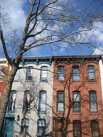
Boerum Hill is a transit powerhouse masquerading as a neighborhood. You're buying proximity to Manhattan—five subway lines within walking distance, including the 2/3/4/5 corridor that defines commuter convenience. The streets themselves are atmospheric: cobblestone blocks, century-old brownstones, and Atlantic Avenue's dense cluster of restaurants and antique dealers create texture that newer Brooklyn developments can't replicate. But the tradeoff is real. You get 132 trees per 200m (decent density), yet only 2/10 canopy coverage, meaning summer heat radiates off pavement. Fort Greene Park is nearly a kilometer away. This is a neighborhood optimized for people who spend their waking hours elsewhere—either commuting into the city or working from home—and need walkable restaurants and reliable transit more than they need green space.
Analysis based on 73 properties scored across 30+ data points

Livability & Restoration
Tree Canopy
132 trees
Avg within 200m | Density: 2/10
10 additional trees per block correlates with health benefits equivalent to being 7 years younger (Kardan et al., 2015)
Park Access
Fort Greene Park
Avg 913m away | Score: 7.3/10
Living within 300m of green space associated with 30% fewer antidepressant prescriptions (Taylor et al., 2015)
Acoustic Quality
5/10
Noise proxy score (higher = quieter)
Chronic noise above 55 dB at night associated with 8% cardiovascular mortality increase (Basner et al., 2014)
Street Character
2.2/10
Enclosure: 2.2/10
What is the ART Score?
ART stands for Attention Restoration Theory (Kaplan & Kaplan, 1989) — the framework environmental psychologists use to measure whether a place helps your brain recover from mental fatigue, or pushes it deeper into overload. Cities deplete directed attention (the effortful focus you use at work); exposure to restorative environments replenishes it.
We compute an ART score for every block by combining four signals: access to restorative zones (parks, museums, libraries), sensory load (nightlife and tourist density), street vitality (Jane Jacobs’ “eyes on the street”), and third places (Oldenburg’s informal community spaces).
In line with the Brooklyn median — typical city stimulus with typical restorative access.
What drives the score
- +Restorative zones. Museums, libraries, community gardens, and parks within walking distance. “Soft fascination” stimuli (clouds, tree branches, water) let directed attention recover without effort — the Kaplans’ core mechanism.
- −Sensory load. Bar and nightclub density (5+ within 150m), firehouse siren corridors, tourist chokepoints, and very high foot traffic push the score down by up to 8 points.
- +Street vitality (Jacobs, 1961). Permitted block parties, farmers markets, and community festivals over the past 12 months — a proxy for “eyes on the street” and the informal surveillance that makes blocks feel safe and maintained.
- +Third places (Oldenburg, 1989). Cafés, public plazas (POPS), community centers — the “anchors of community life” that buffer against social isolation. Loneliness has been linked to 29% higher incident coronary heart disease risk (Valtorta et al., 2016).
Health mechanism. Directed-attention fatigue (DAF) is linked to impaired decision-making, irritability, and elevated cortisol. A meta-analysis of 60+ studies (Ohly et al., 2016) found restorative environment exposure significantly improves attention-task performance (Hedges’ g ≈ 0.32) and reduces negative affect.
Theoretical foundations. Kaplan & Kaplan (1989), The Experience of Nature; Jacobs (1961), The Death and Life of Great American Cities; Oldenburg (1989), The Great Good Place.

Transit & Commute
Subway Stations
Commute Score
9.6/10
Borough median: 8/10
Walk Score Proxy
2.2/10
Based on street geometry analysis

Financial Landscape
Median Price
$965K
Price per Sq Ft
$1283
Price Distribution
Price by Building Type

Investment Indicators
Avg Unused FAR
0 sqft
Development rights potential
Unused development rights valued at $30-$80/sqft in Brooklyn (Glaeser, 2011)
Avg Days on Market
97
Market velocity signal
Multi-Family Stock
0%
2-4 family buildings
Multi-family owner-occupants build 2.4x wealth vs single-family (Herbert, 2013)

Outdoor & Green Space
Avg Tree Count
132
Within 200m radius
Canopy Density
2/10
Normalized canopy coverage
Park Network
- Fort Greene Park
- McCarren Park
Avg distance: 913m
Outdoor Space Types

Practical Living
Building Types
Bedroom Distribution
Laundry Availability
Who Boerum Hill Is For
Manhattan commuters (ages 25-40)
Commute score 9.6/10 with direct 2/3/4/5 lines to Midtown and Lower Manhattan. Cost-of-living lower than Park Slope or Williamsburg with equivalent transit access.
Food-focused professionals
Atlantic Avenue restaurant and antique corridor is your primary neighborhood amenity. High walkability for dining and shopping compensates for limited parks.
Young families with urban flexibility
Brownstone character appeals to families; practical score 5.9/10 reflects adequate—not excellent—neighborhood services. Transit access offsets limited playgrounds.
Pros & Cons
Strengths
Exceptional commute infrastructure
Five subway lines (A, C, F, R, 2, 3, 4, 5) within 400m; commute score 9.6/10 puts you in top 5% of NYC neighborhoods.
Walkable restaurant and retail corridor
Atlantic Avenue's antique and dining cluster creates neighborhood character without relying on parks or public spaces.
Historic architecture and tree-lined blocks
Brownstone streetscape with 132 trees per 200m provides aesthetic appeal and some summer cooling.
More affordable than peer neighborhoods
Similar transit access to Park Slope and Prospect Heights with lower rental/purchase premiums.
Trade-offs
Minimal green space and poor canopy coverage
Outdoor score 2.5/10; only 2/10 canopy density despite 132 trees per 200m means limited shade and cooling.
Nearest major park is a 15-minute walk
Fort Greene Park averages 913m away; no neighborhood-scale parks for daily recreation.
Limited practical neighborhood services
Practical score 5.9/10 suggests gaps in grocery, healthcare, or family amenities relative to commute infrastructure.
Neighborhood identity is transit-dependent
Composite score 5.5/10 reflects that walkability and character are concentrated on Atlantic Avenue; side blocks lack neighborhood draw if you're not commuting.
Score Any Address in Boerum Hill
Get detailed livability scores based on building health, transit access, safety, noise levels, and 15+ NYC data sources.
Search an Address in Boerum HillFrequently Asked Questions about Boerum Hill
1Is Boerum Hill safe?
Boerum Hill safety varies by block. DwellCheck provides detailed safety data including NYPD crime statistics, arrest data, and 311 complaints. Check the Boerum Hill safety page for full details.
2What is the average rent in Boerum Hill?
Rents in Boerum Hill, Brooklyn vary significantly by building and apartment type. The median listing price is $965K. Use DwellCheck to research specific addresses.
3How is transit access in Boerum Hill?
Boerum Hill has a commute score of 9.6/10. 7 subway stations serve the area: Nevins St, High St, Borough Hall/Court St.
4What are the best streets in Boerum Hill?
The best streets depend on your priorities. Use DwellCheck to compare specific addresses across livability, safety, transit, and environmental factors.
5What is Boerum Hill known for?
Boerum Hill sits in Brooklyn and ranks #20 of 32 Brooklyn neighborhoods on DwellCheck's livability score (5.5/10). It's served by 7 subway stations (Nevins St, High St, Borough Hall/Court St), with a median listing price of $965K. Choose Boerum Hill if your commute to Manhattan or your work-from-home routine is non-negotiable and you prioritize restaurant access over parks; otherwise, compare to neighborhoods with stronger outdoor infrastructure at the same transit tier.
6What is it like to live in Boerum Hill?
Living in Boerum Hill, Brooklyn weights against six livability dimensions: practical (HPD-violation density), commute (subway proximity), arts/culture (venue density), outdoor (parks + trees), financial (price level), investment (price trend). Boerum Hill's composite is 5.5/10. Choose Boerum Hill if your commute to Manhattan or your work-from-home routine is non-negotiable and you prioritize restaurant access over parks; otherwise, compare to neighborhoods with stronger outdoor infrastructure at the same transit tier. For the block-by-block view, run any specific Boerum Hill address through DwellCheck.
7Is Boerum Hill expensive?
Median listing price in Boerum Hill, Brooklyn is $965K based on 73 active listings as of 2026-04-05. Whether that reads "expensive" depends on the comparison: it's lower than Manhattan averages and varies considerably by building. Rent-stabilized units in Boerum Hill can run 20-40% below the median; check DHCR rent history for any specific address to verify.
8How is the transit actually distributed?
You have two clusters: Nevins St/Hoyt St (2, 3, 4, 5 lines) on the east side and Borough Hall/Jay St (2, 3, 4, 5, R, A, C, F) on the west. DeKalb Av (B, Q, R) fills the north. Worst-case walk is 5-7 minutes to a line with Manhattan express service.
9Is the tree count actually good?
132 per 200m is above NYC median, but 2/10 canopy density reveals the problem: most are young or small. You'll see sidewalk trees; you won't get the continuous shade of Park Slope or Prospect Heights.
10What does 'practical' 5.9/10 actually mean?
Likely reflects adequate grocery and basic services, but fewer doctors' offices, childcare facilities, or laundromats per capita than high-scoring neighborhoods. You'll handle daily needs but may travel for specialists.
11Who actually lives here vs. passes through?
Residents tend to be young professionals and small families using transit daily for work. Atlantic Avenue crowds on weekends are often visitors. The neighborhood rewards commuters; casual strollers find it thin outside restaurants.
Related Guides
NYC Building Complaints Lookup
Check any building's HPD, DOB, and 311 complaint history before signing.
30 NYC Apartment Red Flags
What to watch for at the viewing, in the listing, and on the landlord.
How to Check Your NYC Landlord
A 5-step free lookup: ACRIS ownership, HPD violations, DOB complaints, lawsuits.
Is My Apartment Rent-Stabilized?
Request a free DHCR rent history and verify stabilization status in 24-72 hours.