

The Data
Every NYC neighborhood has a crime rate on record. The NYPD's Complaint Data Historic feed, published on NYC Open Data, logs every reported crime with a precise location and date. We aggregate that by NYC Neighborhood Tabulation Area (NTA) and normalize to average crimes per 300-meter walking radius — roughly a 3-4 minute walk, the distance that actually affects daily living.
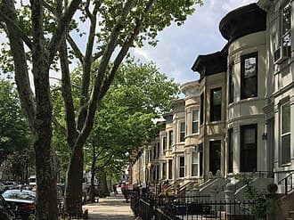
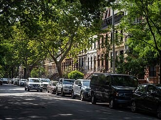
The 15 Safest NYC Neighborhoods
Lower is better. All values are average crime reports per 300-meter walking radius, aggregated across every residential building in the NTA over the last 12 months of NYPD data.
| Rank | Neighborhood | Borough | Crimes / 300m |
|---|---|---|---|
| #1 | Riverdale-Spuyten Duyvil | Bronx | 6 |
| #2 | Brooklyn Heights-Cobble Hill | Brooklyn | 7 |
| #3 | Upper East Side-Carnegie Hill | Manhattan | 8 |
| #4 | Brooklyn | 9 | |
| #5 | Park Slope-Gowanus | Brooklyn | 10 |
| #6 | Bensonhurst West | Brooklyn | 10 |
| #7 | Carroll Gardens-Columbia St-Red Hook | Brooklyn | 11 |
| #8 | Sheepshead Bay-Gerritsen Beach | Brooklyn | 11 |
| #9 | DUMBO-Vinegar Hill-Downtown Brooklyn | Brooklyn | 12 |
| #10 | Brooklyn | 12 | |
| #11 | Brooklyn | 13 | |
| #12 | Brooklyn | 14 | |
| #13 | Queens | 14 | |
| #14 | Brooklyn | 18 | |
| #15 | Brooklyn | 18 |


Data source: NYPD Complaint Data Historic via NYC Open Data. Updated 2025-01.
ℹ️A note on what the numbers mean
These are reported incidents — a combined score that doesn't separate violent crime from property crime from quality-of-life calls. A low score is strongly correlated with all of them, but a neighborhood can be "safe" in one category and not another. For a breakdown by crime type, check any specific address on DwellCheck.
Borough-Level Comparison
If you're deciding on a borough before zooming into neighborhoods, here's how the five boroughs rank on the same crime-per-300m metric:
| Rank | Borough | Crimes / 300m | Shootings / 500m |
|---|---|---|---|
| #1 | Staten Island | 100 | 0.5 |
| #2 | Queens | 180 | 1.5 |
| #3 | Brooklyn | 224.5 | 1.4 |
| #4 | Bronx | 260 | 3 |
| #5 | Manhattan | 280 | 1 |
Check a Specific Address
Neighborhood averages are a starting point. Enter any NYC address to see block-level crime data, 311 safety complaints, and a walking-radius score.
Check Any Address — $2.99Methodology
Every data point on this page is reproducible from public sources. Here's exactly how we calculated it:
- Source: NYPD Complaint Data Historic (NYC Open Data dataset
qgea-i56i). - Time window: The most recent 12 months of reported incidents.
- Geographic unit: NYC Neighborhood Tabulation Areas (NTAs) — the Census-defined neighborhood boundaries used by the city for planning.
- Normalization: For each residential address in the NTA, count crime reports within a 300-meter walking radius. Average across all addresses in the NTA.
- Crime types: All NYPD complaint categories, weighted equally. Violent, property, and quality-of-life offenses are combined for the headline metric.
- Excluded: NTAs with fewer than 50 residential addresses (too few samples for a stable average).
The result is a density-corrected crime score that reflects "how much crime is happening in the places people actually walk to" — not raw incident counts, which would penalize larger neighborhoods.
Caveats You Should Know
Three things to keep in mind before you take any ranking as final:
- Reported ≠ actual. The NYPD data captures reported incidents. Over-policed neighborhoods can look worse than they are; under-reported areas can look safer.
- Averages hide blocks. A neighborhood can have a low average with dangerous corridors. Always check the specific address.
- This is a snapshot. Safety trends move over years. A ranking from 2020 would have placed several neighborhoods very differently. Use these numbers as current, not permanent.
Frequently Asked Questions
1How do you rank the safest NYC neighborhoods?
We rank by average NYPD crime complaints per 300-meter walking radius across each NYC Neighborhood Tabulation Area (NTA). Lower is better. The 300m radius approximates a 3-4 minute walk — the distance that actually affects daily living — and covers all major crime categories (violent crimes, property crimes, quality-of-life offenses). Data is pulled directly from NYC Open Data NYPD feeds.
2What is the safest borough in NYC?
Based on NYPD crime data per 300m walking radius: 1. Staten Island (100 incidents), 2. Queens (180 incidents), 3. Brooklyn (224.5 incidents), 4. Bronx (260 incidents), 5. Manhattan (280 incidents). The rankings are relatively stable year-over-year, though individual neighborhoods within each borough can vary significantly.
3Does a low crime rate guarantee safety?
No. Crime rates are averages across a neighborhood — safety can vary block by block. A neighborhood with a low average can still have dangerous stretches, especially near certain transit hubs or commercial corridors. Always check crime data for the specific address you're considering, not just the neighborhood name. DwellCheck provides block-level analysis within a 400m radius for any NYC address.
4Why do some well-known "safe" neighborhoods not appear on this list?
Some neighborhoods people perceive as safe rank lower in the data than expected because the NYPD reporting area includes adjacent commercial strips, transit hubs, or areas with higher crime that get averaged in. This list shows the raw data; use it as one input alongside your own research and an actual address-level check.
5What data sources power these rankings?
NYPD Complaint Data Historic (publicly available at data.cityofnewyork.us), filtered to complaints in the past 12 months, aggregated by NYC Neighborhood Tabulation Area (NTA). Walking-radius density is calculated against building footprints using geospatial joins. All math is transparent and reproducible; see our methodology page.
6How often is this list updated?
NYC's NYPD CompStat data updates quarterly. This list was last updated using data from 2025-01. Small month-to-month fluctuations shouldn't change the rankings much, but major shifts (new policing initiatives, gentrification waves) can move neighborhoods up or down over years.
7How do I check safety for a specific address?
Enter the address on DwellCheck — we pull NYPD crime, arrests, shooting incidents, and 311 safety complaints within a 400-meter walking radius and compare them to the neighborhood baseline. You'll see a block-level safety score (0-100) and a breakdown of which crime types are elevated.
8Is this a fair ranking given gentrification and policing bias?
The rankings reflect reported incidents, not lived experience. Over-policed neighborhoods may appear worse than they are; under-reported incidents in wealthier areas can mask real issues. We publish the raw methodology so readers can form their own conclusions. Use these rankings as a starting point, not a final verdict.
The Bottom Line
NYC's safest neighborhoods are the ones where the numbers hold up under scrutiny. The 15 above come from live NYPD data, not marketing copy. Use them as a starting point — then check the specific block and building before you sign anything.
Check Safety for Any NYC Address
Get block-level NYPD crime data, 311 safety complaints, and a walking-radius breakdown for any NYC address — free.
Check Any Address — $2.99No account needed. Results in under 30 seconds.